


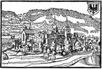


A while ago I did a number of outline drawings of 18th century fortified towns, including Prague, Mannheim, Minden and a few others, based on contemporary plans. I could make an .svg file of them available if anyone is interested in using them; they could be useful e.g. on fairly large-scale campaign maps, fictional or otherwise. If I were to do so, would people like them to show the approximate street plans and areas of building, or would they be happy to have the outline only? (They do not at the moment include the street plans so it would take me a while to add them.) They are also currently not to scale but I could spend time adding a scale and then adapting them all so they are shown at the same scale. Obviously it would be much quicker to release them as they are but I'd be happy to do the aforementioned "improvements" if that would make them more useful.
Anyway, I look forward to your comments. Thanks.
David.
Sunday, 7 June 2009
18th century fortified town outlines I've drawn; a few questions
Subscribe to:
Post Comments (Atom)

Sir David, Street plans would be interesting if only to be used in an abstract way for game set ups...
ReplyDeleteHi Bill,
ReplyDeleteThanks for commenting; that's one vote for street plans and built-up areas! :-)
All the best,
David.